Town circuit
18 plaques · about 75 minutes
The Market Place and Kirkgate, including Herriot's earlier plaque and the museum.
Add to my day
Plan a day in Thirsk · 21 stops
Twenty blue plaques around Thirsk and Sowerby in walking order from our door, plus the new James Herriot plaque at Rowardennan
Choose your walk
18 plaques · about 75 minutes
The Market Place and Kirkgate, including Herriot's earlier plaque and the museum.
20 plaques · about 1 hour 45 minutes
Continue to the two Front Street plaques in Sowerby. Read their stories.
20 plaques plus one · allow at least 2 hours 10 minutes
Finish at Rowardennan, the newly marked writing home. The extra leg has not yet been timed by us.
Make it a Herriot day: visit the World of James Herriot museum at stop 7 before walking on. The original surgery and the new writing-home plaque tell different parts of Alf Wight's story.
Add to my dayThirsk and Sowerby have twenty blue plaques in the town's scheme, and since October 2026 one more outside it. That new one honours Alf Wight, the vet and author James Herriot, at Rowardennan, the Sowerby home where he wrote much of his work. The original twenty stops are free and outdoors, and between them they tell you why a town of this size has the shape it has: a coaching route, a railway, a market, and an unusual number of people who left and became well known somewhere else.
The town put the scheme together and the Tourist Information Centre has a printed leaflet for the original twenty. This page keeps those twenty in their established walking order and adds Rowardennan as an optional final stop. Our map pin for the new stop is approximate until we can check it on the ground; the World of James Herriot walking guide identifies the house between numbers 96 and 98 Topcliffe Road. You can print this page or carry it on a phone.
The names worth the walk on their own: Thomas Lord, who founded the cricket ground that still carries his name, born on Kirkgate. Alf Wight, who was James Herriot, four minutes further up the same street. Bill Foggitt, who forecast the weather from a chemist's shop on the market square by watching what the animals did. And a nurse called Hannah Packer, who left for Uruguay in 1882.
Start at our door, 87 Market Place. The first plaque is on the wall of Boots, thirty seconds away, and eighteen of the twenty are within five hundred metres of the square. The other two are together on Front Street in Sowerby. Rowardennan is farther along Topcliffe Road, so treat it as an extension rather than assuming it is beside the Front Street pair.
If you are coming by car, Marage Road is the largest car park and a five minute walk in. The station is a different matter: it sits about a mile and a half west at Carlton Miniott, which is a half-hour walk or a pre-booked taxi, so plan for that rather than assuming a rank.
Walk the first twenty in numbered order: four plaques on the market square, up Kirkgate and back for the museums, east along Finkle Street and Ingramgate to the workhouse on Sutton Road, then west through Westgate and Station Road, and finally south down Chapel Street and out under the lime avenue to Sowerby. The line on our map ends with that original route; stop 21 is marked separately.
You do not have to do all of it. The town circuit is stops 1 to 18 and takes about an hour and a quarter without leaving Thirsk. The Sowerby pair is stops 19 and 20, forty yards apart on Front Street: Hannah Packer, who sailed for Uruguay in 1882, and Joan Maynard, who organised for the farm workers' union.
It is fifteen minutes out to them from the cinema end of town and fifteen back, so half an hour plus reading time. If you would rather not retrace the pavement, come back over Sowerby Flatts and up the beck instead. That turns the half hour into about an hour, and it is worth it. For stop 21, follow the Herriot guide's longer route via Gravel Hole Lane to Topcliffe Road. It is a private house, so stay on the public pavement.
Read the plaque, then look at the building. Half of these are worth more attention than the plaque gives them: the Cross Keys is medieval above the ground floor, the Golden Fleece has the arched coaching entry down its side, and the workhouse on Sutton Road is the one that changes how the rest of the walk reads.
Three of the stops are places you can go inside, and all three are on the town circuit. Thirsk Museum is the house Thomas Lord was born in. The World of James Herriot is Alf Wight's surgery. The Ritz is still showing films. Any of the three turns the walk into an afternoon.
The original twenty-stop walk is about two and a half miles and an hour and three quarters including the reading. Allow around two hours and ten minutes if you add Rowardennan, though we have not yet timed that extension ourselves.
Do the town circuit and stop, if you only have an hour and a quarter. Stops 1 to 18 never take you out of Thirsk, they are flat and close together, and they include both museums and the cinema. The three in Sowerby are a separate walk and worth keeping for a day you can give them properly.
Stops 19 and 20 are close to each other but well away from the town circuit. Stop 21 is farther still. All three are worth seeing, but the first eighteen make a complete shorter walk.
Take a photograph of each plaque rather than trying to read every word standing up. Several are set above head height and a few have weathered.
Sunday is the quietest day for this. Market days, Monday and Saturday, make the square stops harder to stand in front of, though the market itself is worth the trade.
The plaques are outdoors and free, so this is the walk that still works when the weather has ruined the rest of the plan. It is also the one to do first if you have just arrived and want the town to make sense.
The walk
Distances are from our door at 87 Market Place, measured stop to stop.
Stops 1 to 18 · 1.5 miles · 75 min
Eighteen plaques without leaving the town, starting at the shop next door and finishing on Chapel Street. Every one of them is within five hundred metres of our door, so this is the version you can do on an afternoon off and still be back for tea.
Stops 19 to 20 · 1.1 miles · 30 min
These two plaques are forty yards apart on Front Street. Allow fifteen minutes out under the lime avenue from the cinema end of town and fifteen back, plus reading time. This remains the end of the original twenty-stop route; Rowardennan is a further extension.
Stops 21 to 21 · 800 m · 25 min
Continue through Sowerby towards Topcliffe Road for Alf Wight's former family home. This adds a substantial walk beyond the Front Street pair. Use the World of James Herriot walking guide for directions; our time and distance are provisional until we walk it.
All 21 stops · 3.1 miles · 130 min
Walk the town first and finish in Sowerby, which puts the two best plaques at the end and gets you home along the beck rather than back down the pavement. Allow a morning, and start after breakfast.
Boots Chemist, Market Place · 44 m from the last stop · 44 m so far
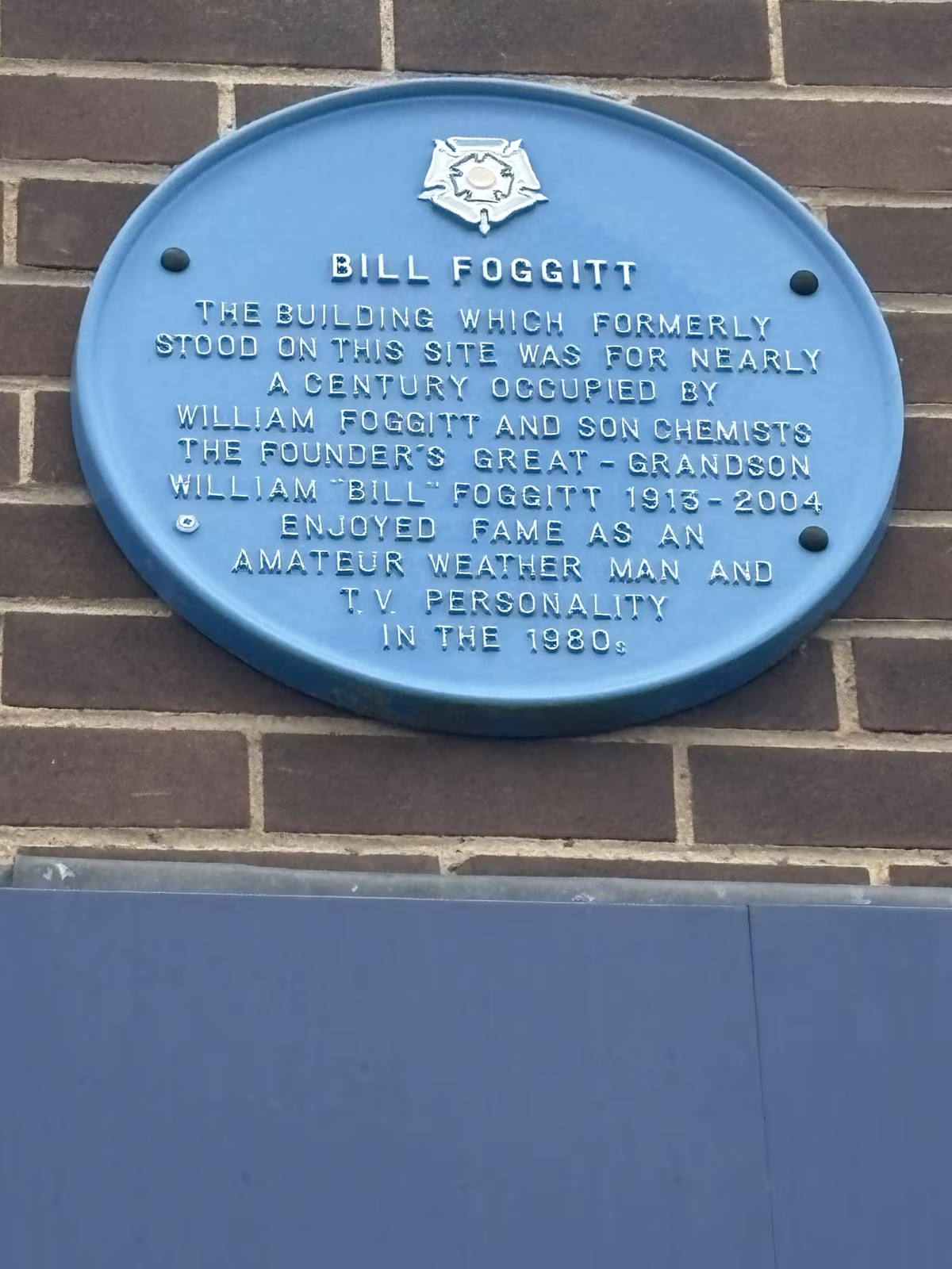
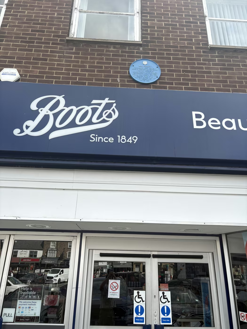
Bill Foggitt forecast the weather by watching moles, frogs and seaweed, and did it well enough to become a fixture on national television through the 1980s. He was the great-grandson of the William Foggitt whose chemist's shop occupied this site for nearly a century. Read the plaque carefully, though: the building it describes is the one that formerly stood here, not the one it is fixed to.
BILL FOGGITT. THE BUILDING WHICH FORMERLY STOOD ON THIS SITE WAS FOR NEARLY A CENTURY OCCUPIED BY WILLIAM FOGGITT AND SON CHEMISTS. THE FOUNDER'S GREAT-GRANDSON WILLIAM 'BILL' FOGGITT 1913-2004 ENJOYED FAME AS AN AMATEUR WEATHER MAN AND T.V. PERSONALITY IN THE 1980s
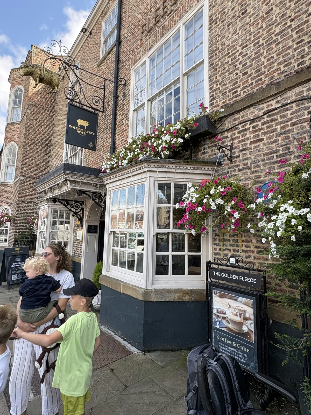
Golden Fleece Hotel, Market Place · 35 m from the last stop · 79 m so far
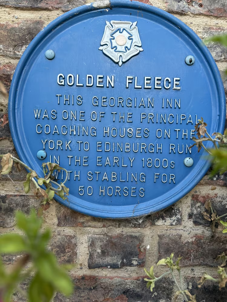
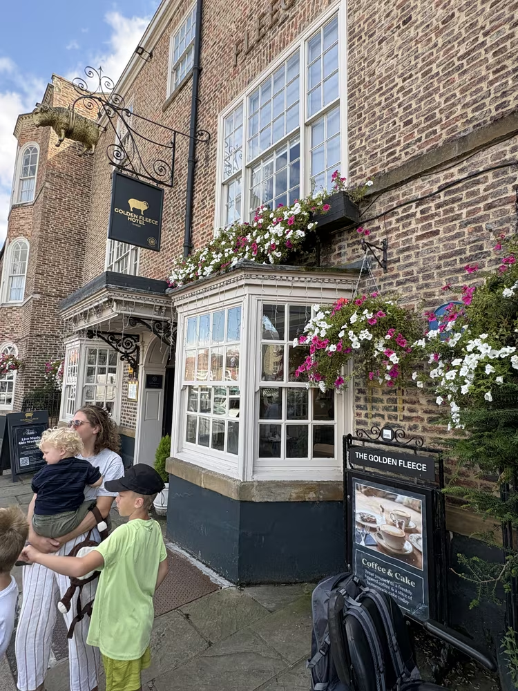
A coaching inn on the Royal Mail route between London and Edinburgh, with stabling for around fifty horses behind it. The coaching trade is why the market square is the shape it is, wide enough to turn a team in, and why so many of the buildings facing it have arched entries down the side.
Bakers Alley · 88 m from the last stop · 167 m so far
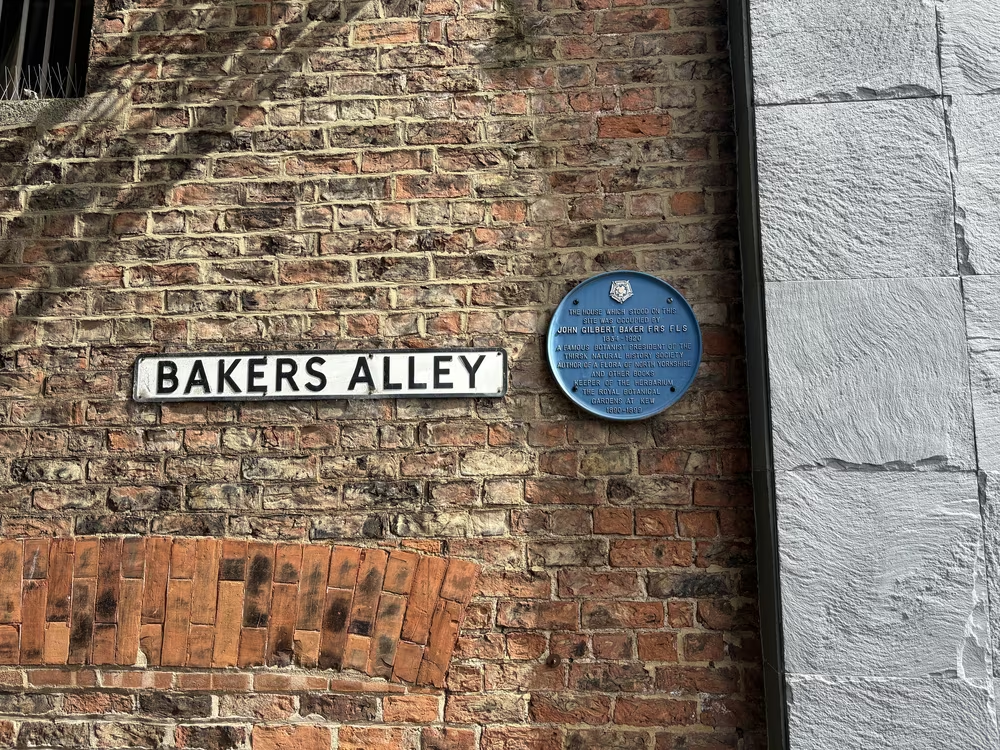
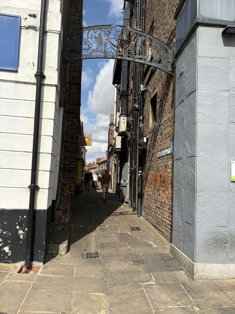
Baker was born in Guisborough in 1834 and his family moved to Thirsk the same year. He spent eighteen years working in the family drapery on this spot before leaving for Kew, where he became Keeper of the Herbarium and a Fellow of the Royal Society. The drapery building burned down in 1864.
Three Tuns Hotel, Market Place · 156 m from the last stop · 324 m so far
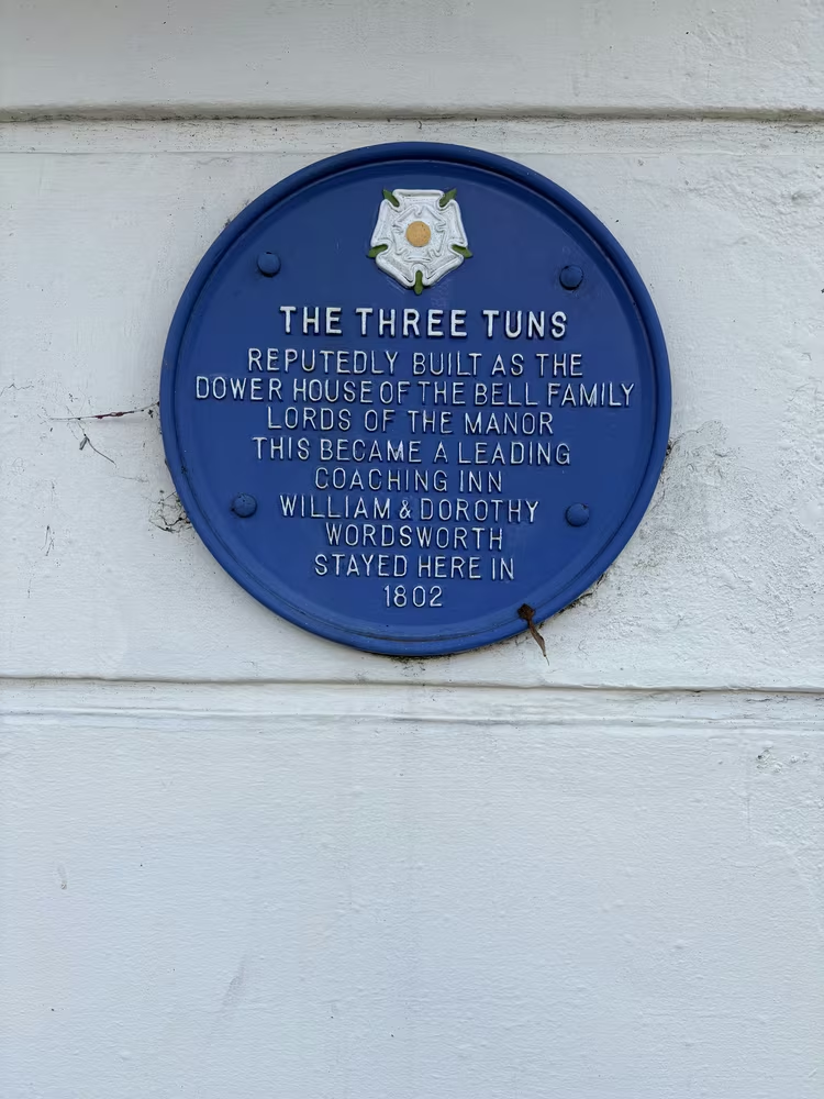
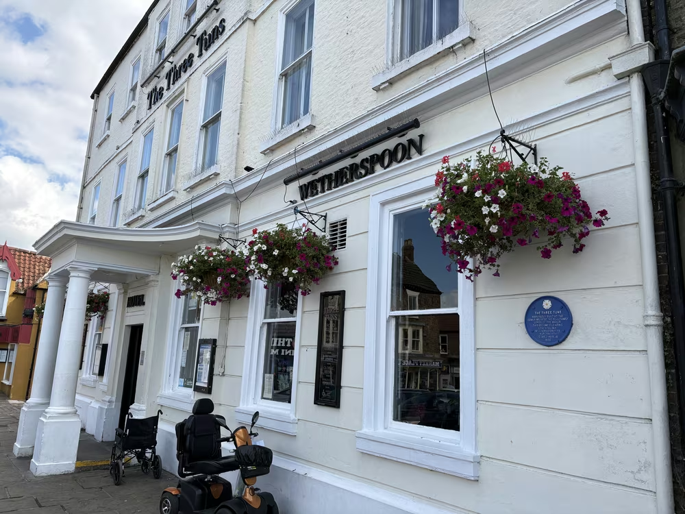
The Wordsworths stopped here on their way across Yorkshire, which is the sort of thing that happens to a town sitting on the main road north. The building may earlier have been a dower house of the Bell family. Worth reading for the reminder that Thirsk was a staging post long before it was a destination.
14 to 16 Kirkgate · 257 m from the last stop · 580 m so far
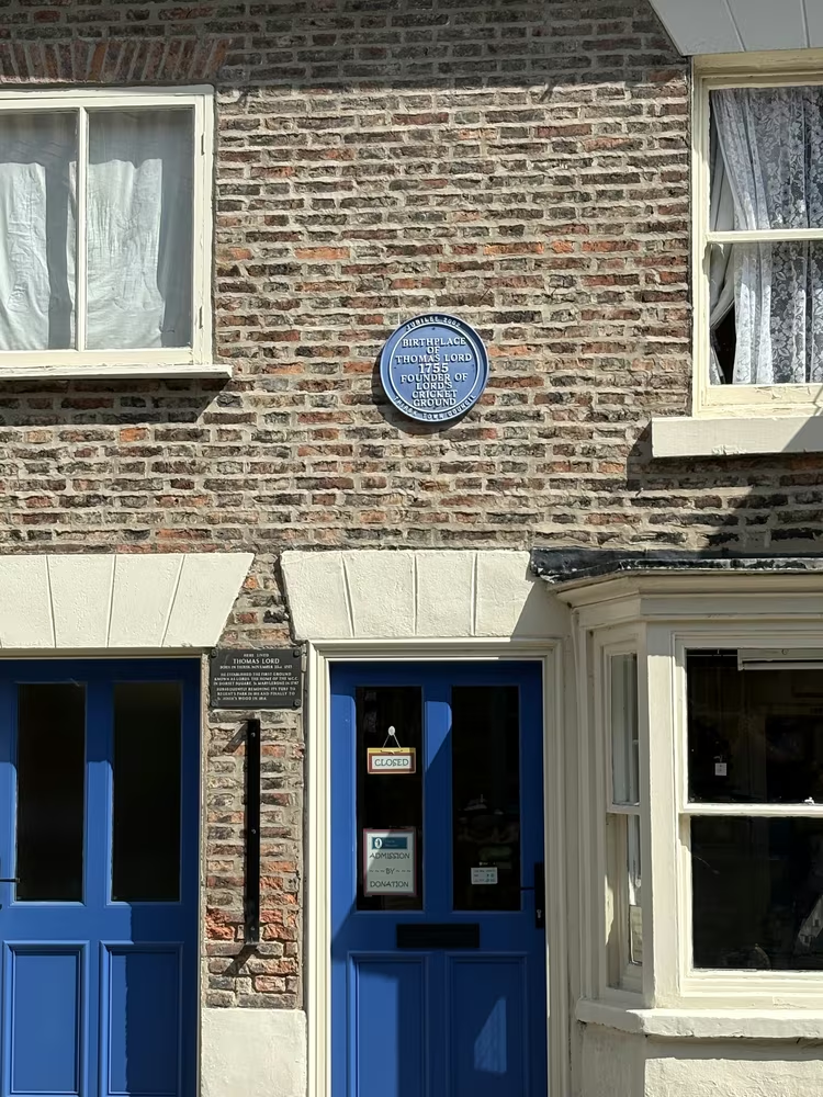
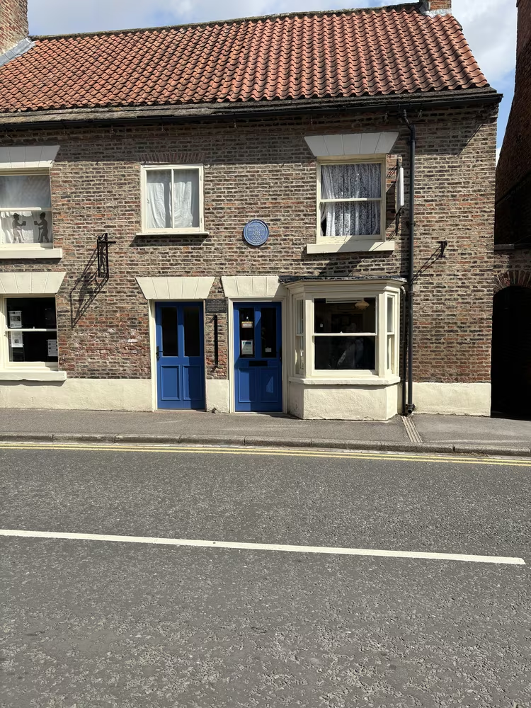
Born here on 23 November 1755, Lord opened his first cricket ground at Dorset Square in 1787, lifted the turf and moved it to Regent's Park in 1811, then moved it again to St John's Wood in 1814, where it still is. Two plaques mark the house, one blue and one black. It is now Thirsk Museum.
Here lived Thomas Lord born in Thirsk, November 23rd 1755. He established the first ground known as Lords, the home of the M.C.C.
23 Kirkgate · 34 m from the last stop · 614 m so far
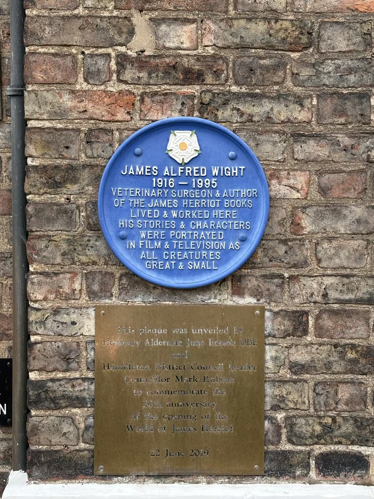
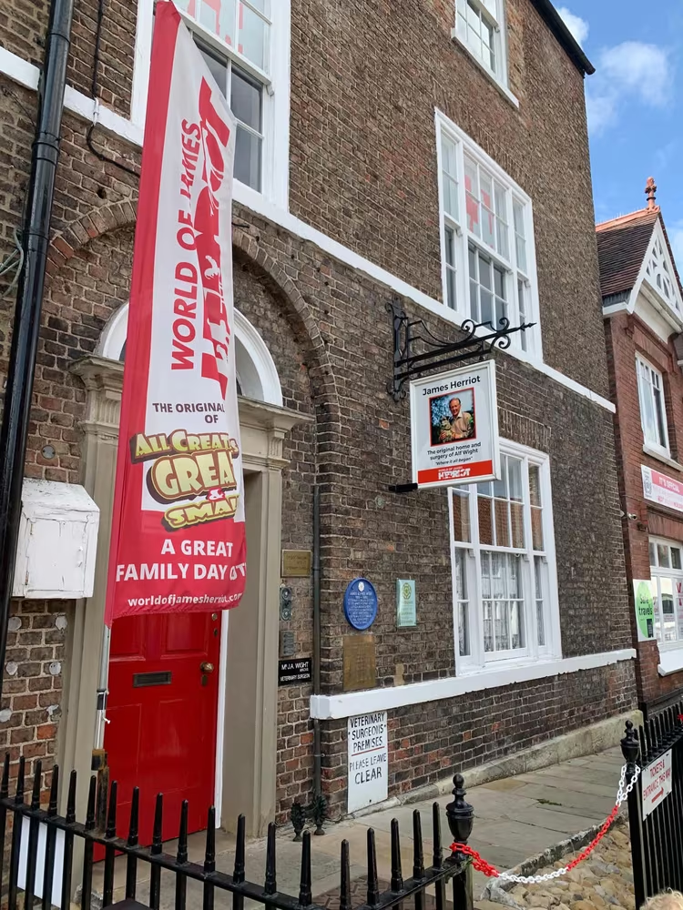
Alf Wight practised as a vet from this house and wrote the Herriot books about doing it. He lived from 1916 to 1995. The building is now the World of James Herriot, with the ground floor dressed as the surgery was in the 1940s, so this is the one plaque where it is worth going inside.
Cross Keys Public House, Kirkgate · 67 m from the last stop · 682 m so far
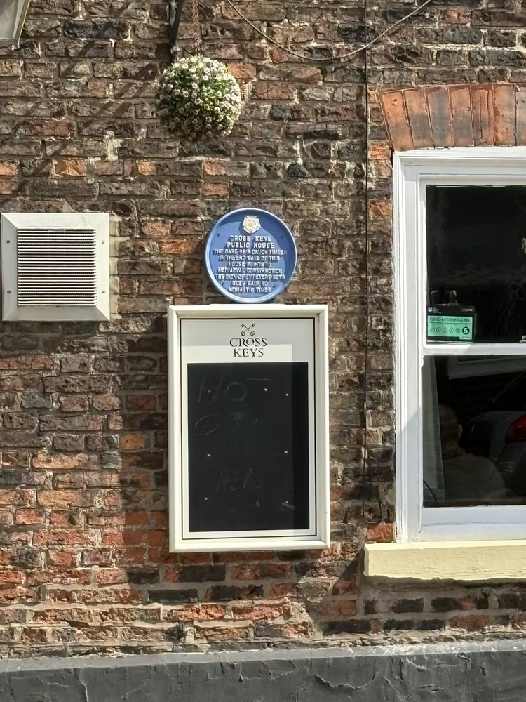
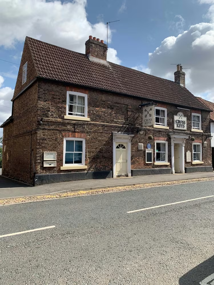
Timber-framed and medieval behind a later front, with a monastic connection in its history. Look up rather than at the door: the upper storey is where the age shows, and it is easy to walk past at eye level without noticing the building is several centuries older than its neighbours.
Thirsk Hall, Kirkgate · 72 m from the last stop · 754 m so far
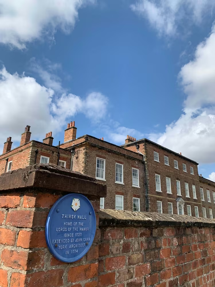
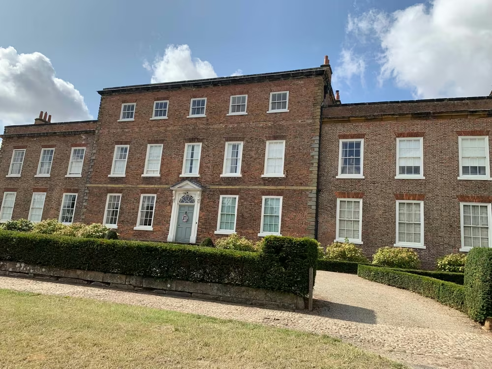
Home of the Lords of the Manor since 1723 and extended by John Carr, the York architect responsible for a good deal of what Georgian Yorkshire looks like. The hall now runs a sculpture park in its grounds, which is ticketed and seasonal, so check before you plan around it.
Finkle Street · 461 m from the last stop · 0.8 miles so far
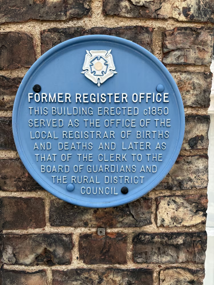
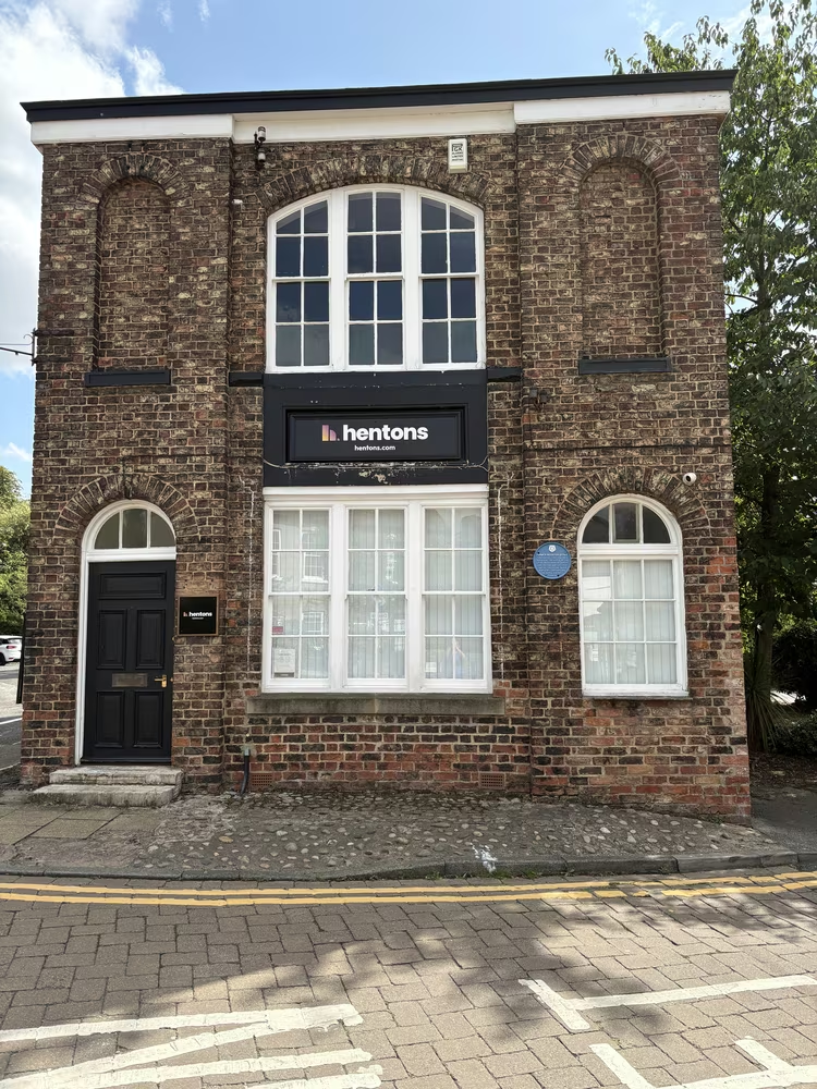
Built in the late 1840s to record births, marriages and deaths for the district, a few years after registration became compulsory. A small building for a large administrative change. Everyone born, married or buried around Thirsk for the best part of a century has a line in a ledger that started here.
Thirsk Library, Finkle Street · 49 m from the last stop · 0.8 miles so far
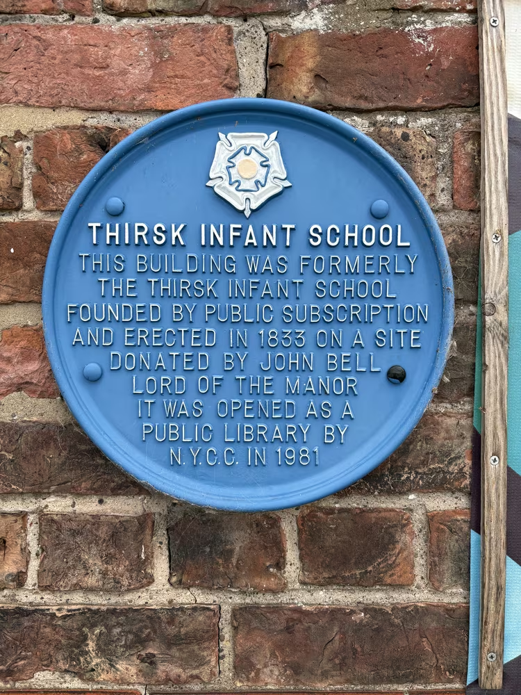
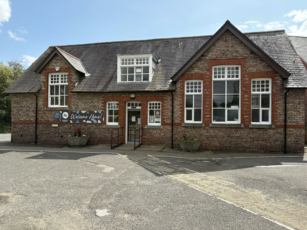
Founded in 1833 by public subscription, which is to say the town paid for it themselves before the state would. It became the public library in 1981 and has changed hands again since, and is now home to Family Life Church. Two centuries of the same building being used to bring people together, in one form or another.
7 to 11 Ingramgate · 144 m from the last stop · 0.9 miles so far
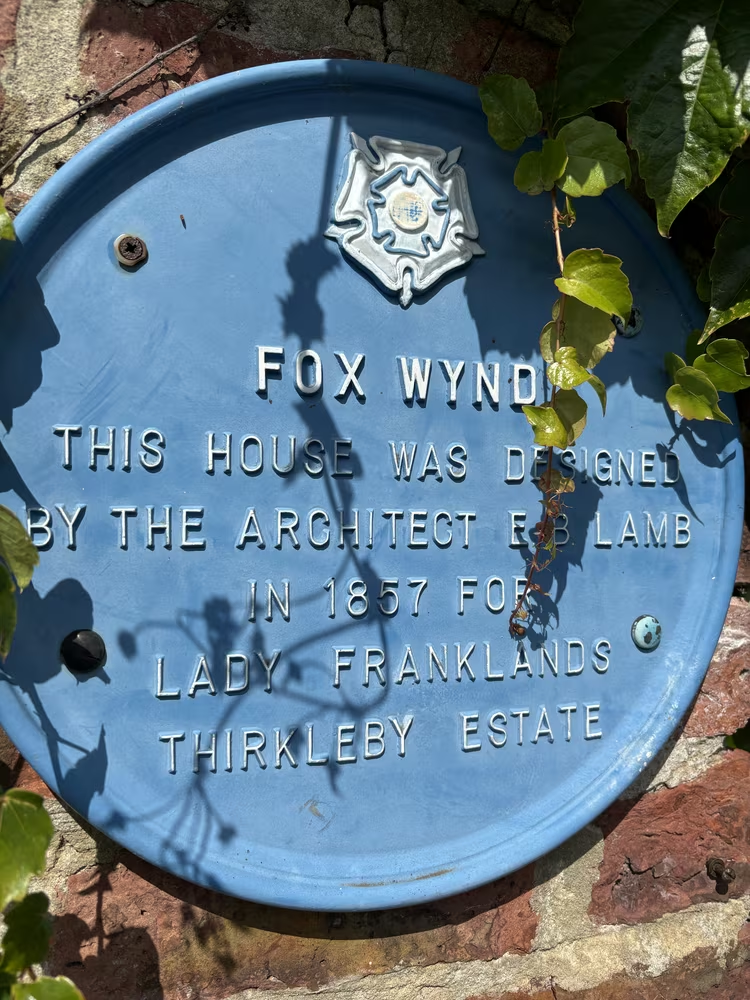
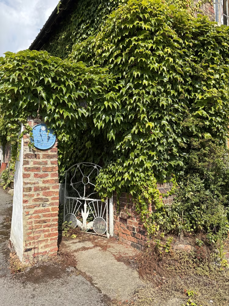
Designed in 1857 by Edward Buckton Lamb for the Frankland estate. Lamb was a Victorian architect with a reputation for going his own way, and this is the plaque where architecture people slow down. If you have no interest in Victorian domestic design, this is a short read and a pleasant street.
Sutton Road · 228 m from the last stop · 1.0 miles so far
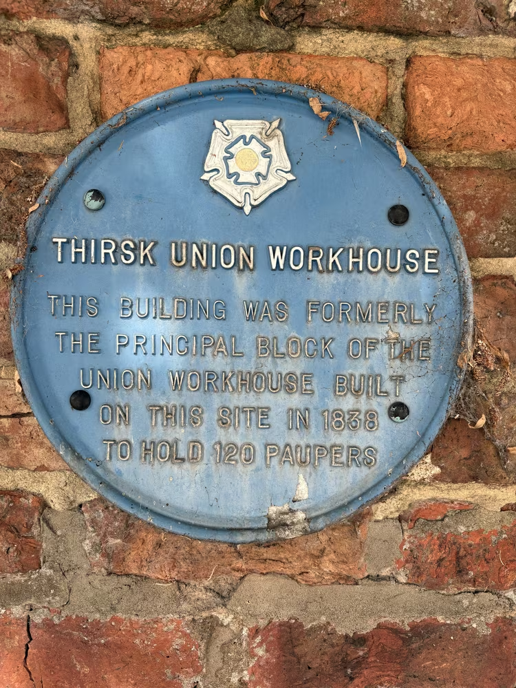
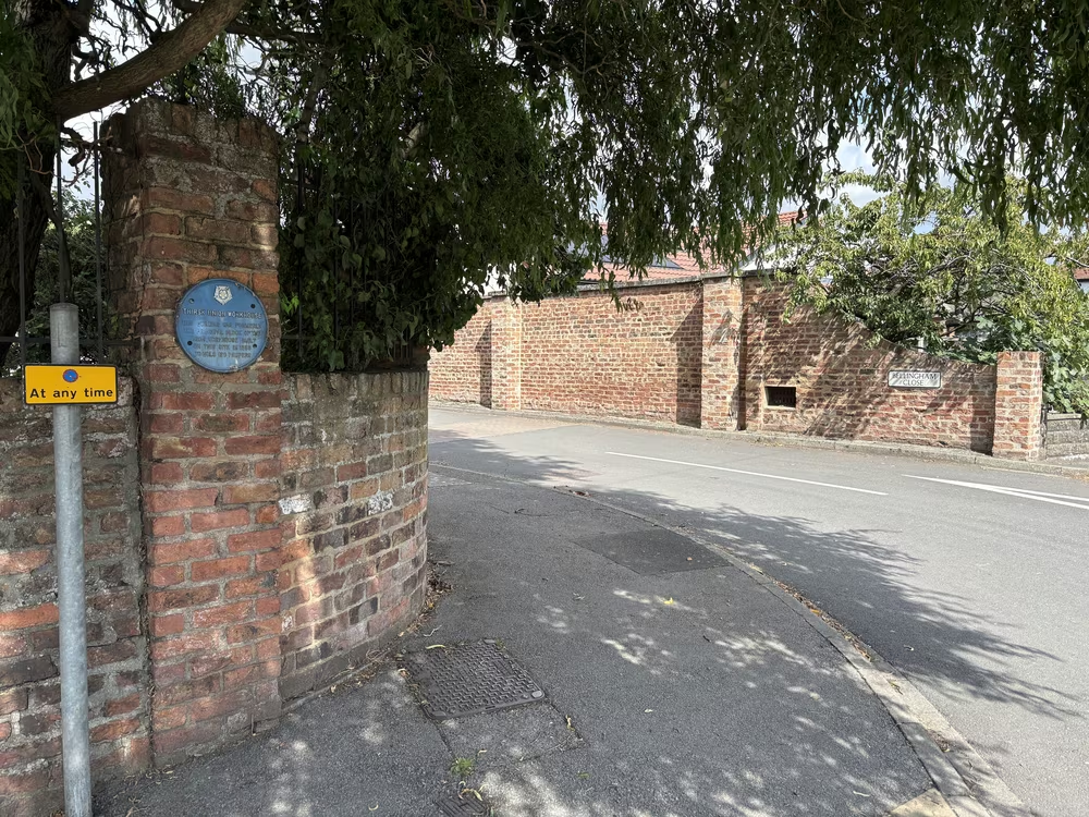
The workhouse served forty parishes and was built to hold 120 paupers, the figure both the plaque and the Poor Law Commissioners give. It is the least comfortable stop on the walk and the most worth making, because it is the other half of the Victorian story the rest of these plaques tell. This is the turning point of the loop.
Old Courthouse, Westgate · 878 m from the last stop · 1.6 miles so far
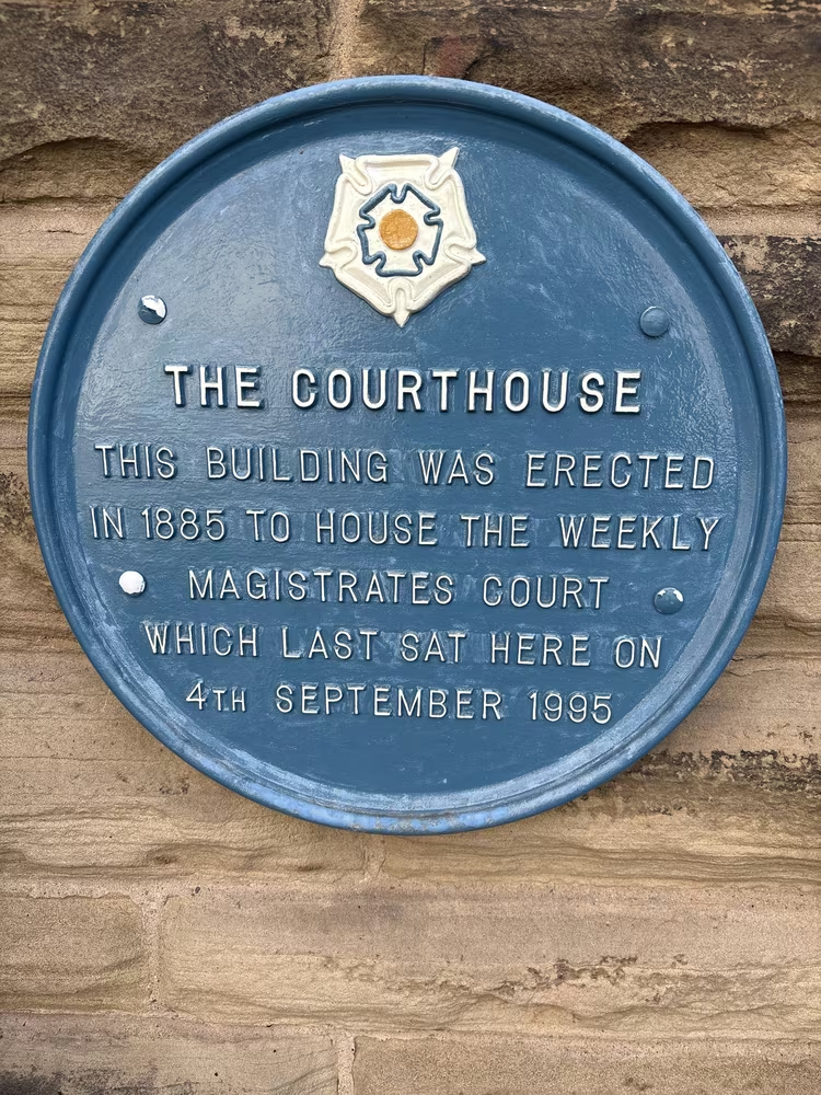
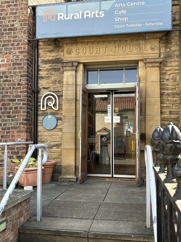
Built in 1885 for the magistrates and closed in 1995, after 110 years of the town's small crimes and licensing rows. Courts consolidated into larger towns, which is why so many market towns have a handsome civic building looking for something to do. It is now home to Rural Arts, an arts centre with a café and shop.
Westgate · 94 m from the last stop · 1.6 miles so far
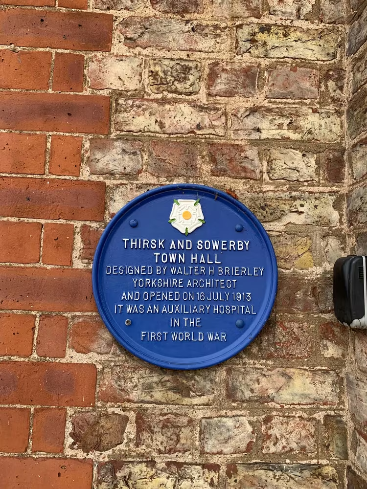
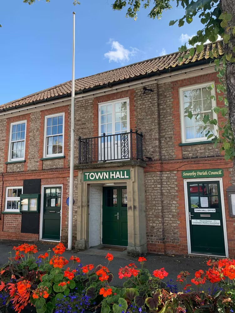
Built by a company of local citizens who put up the money themselves, and designed by Walter Brierley, the York architect sometimes called the Lutyens of the north. It served as a hospital during the First World War. A town hall paid for by subscription rather than by a council says something about the place.
Westgate · 24 m from the last stop · 1.6 miles so far
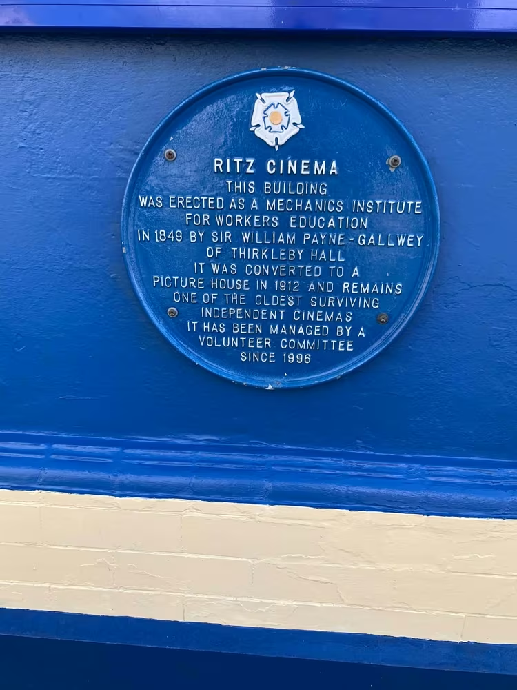
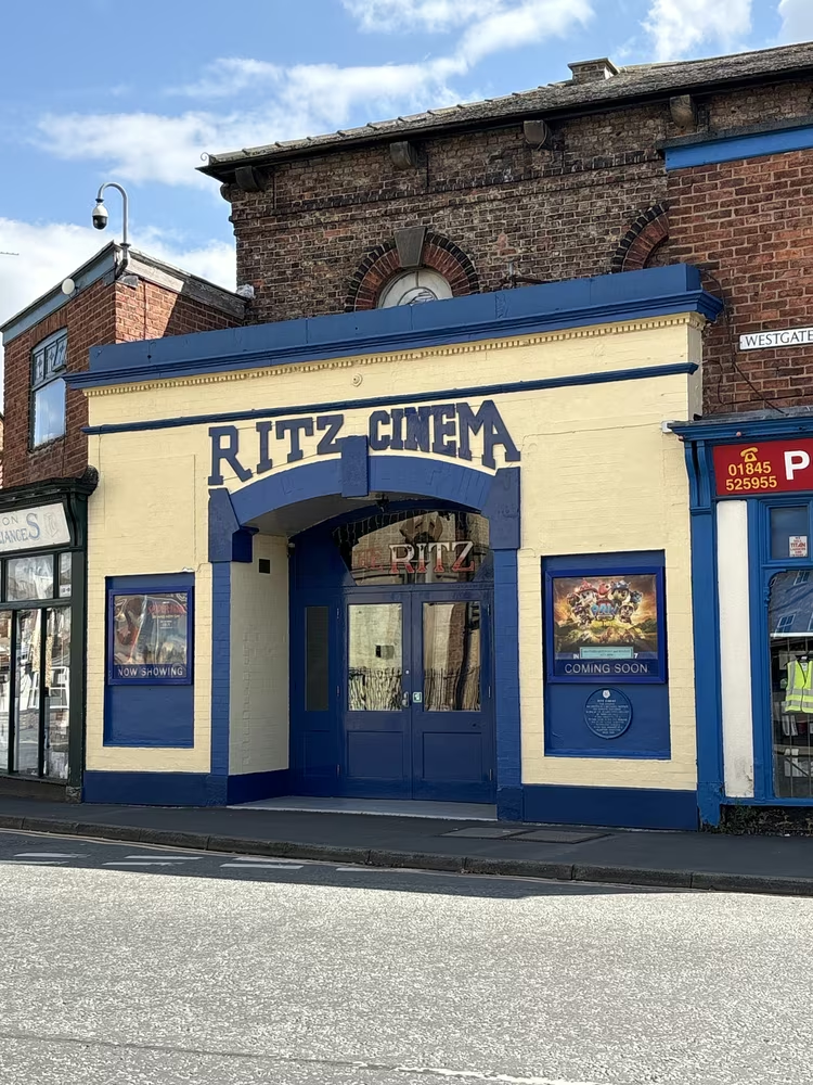
The building began as the Mechanics' Institute, a Victorian invention for the education of working men, and became a cinema early in the twentieth century. It is still a working cinema, which after that many changes of use is the interesting part. Showtimes are on its own page.
Station Road · 164 m from the last stop · 1.7 miles so far
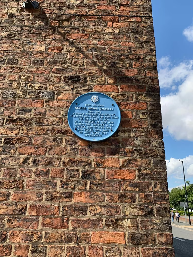
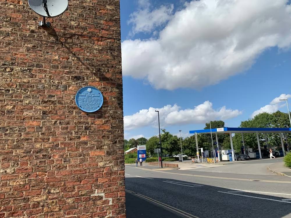
Born here in 1897, Macaulay bowled for Yorkshire and for England, and died on active service in 1940. Thirsk has produced the founder of Lord's and a Test bowler within a few hundred yards of each other, which for a town this size is a strange amount of cricket.
Off Station Road · 209 m from the last stop · 1.9 miles so far
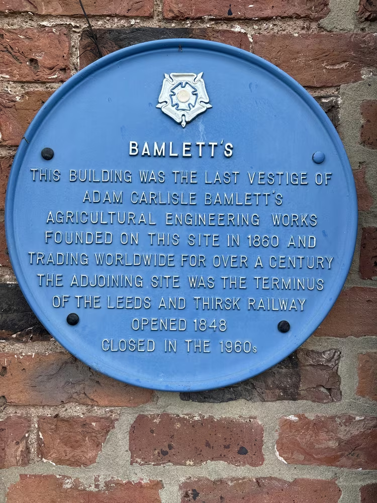
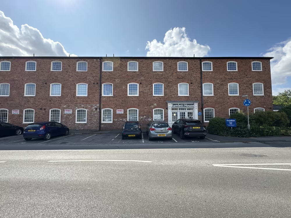
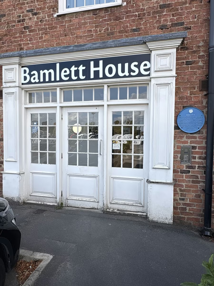
A. C. Bamlett founded the works in 1860, making harvesting machinery that went out to farms across the north. The railway reached Thirsk in 1848 and the works followed, which is the whole story of Victorian light industry in one sentence. The old works building is now Bamlett House, offices with a Tesco superstore next door on the rest of the site.
Lambert Hospital, Chapel Street · 400 m from the last stop · 2.1 miles so far
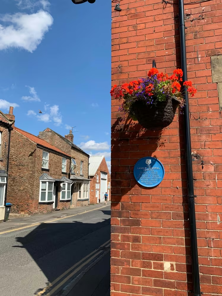
Founded in 1890 by Sarah Lambert of Sowerby, in memory of two men: her husband, and his father William Lambert, who came to Thirsk about 1815 after serving as an assistant surgeon with the Grenadier Guards in the Peninsular War. Thirsk had a cottage hospital paid for by one family before the National Health Service existed, which was how a great deal of rural medicine worked. The building is now known as The Lambert, and is home to Herriot Hospice Homecare.
Front Street, Sowerby, opposite St Oswald's church · 728 m from the last stop · 2.6 miles so far
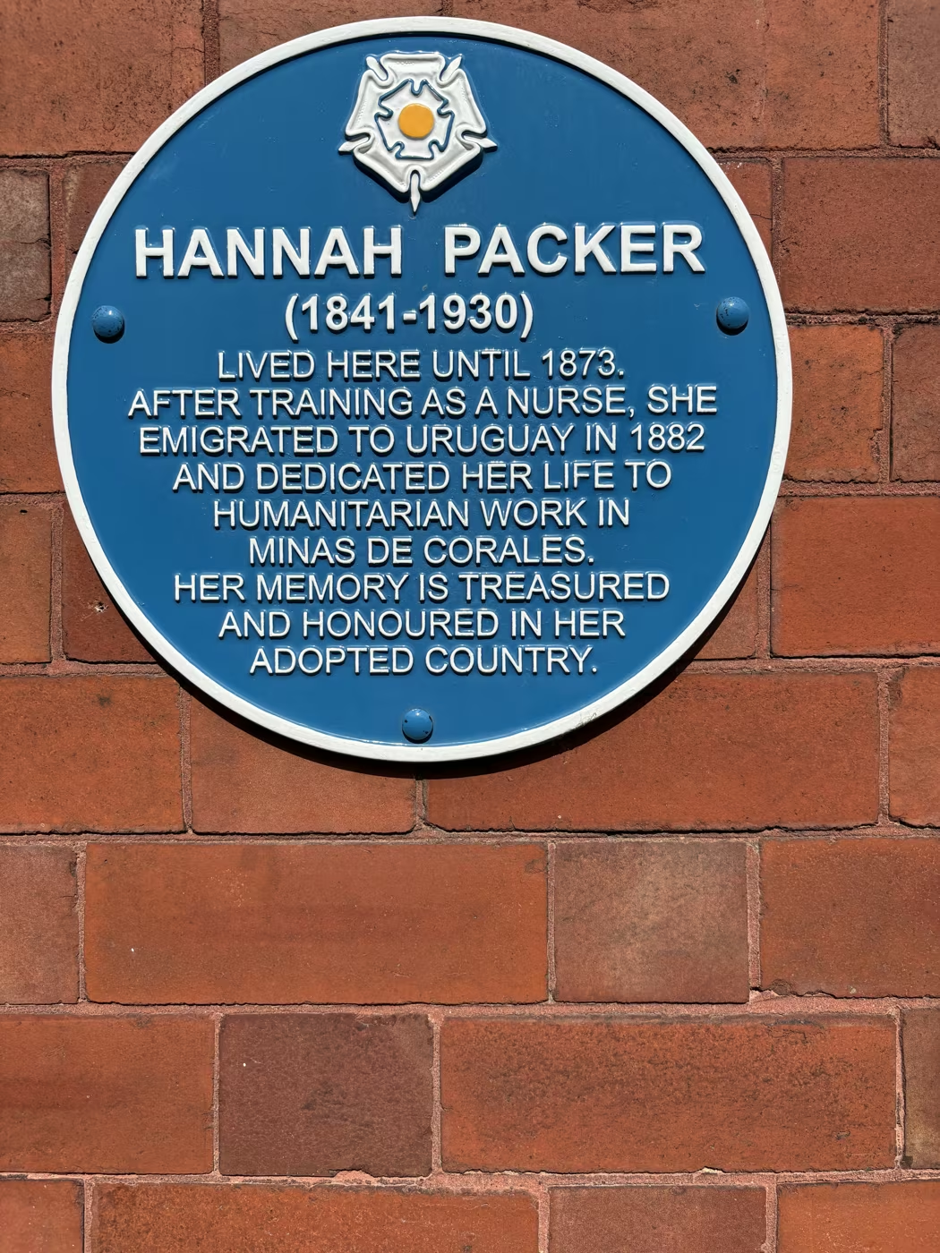
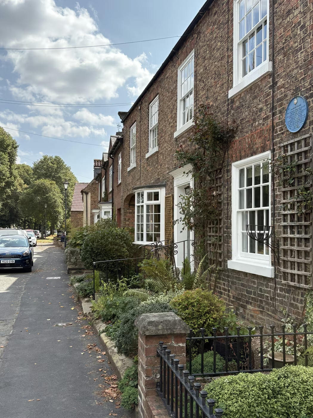
Hannah Packer trained as a nurse and in 1882 left Thirsk for Uruguay, which in the 1880s meant a sea voyage of several weeks to a country most of her neighbours could not have placed on a map. She lived to 1930. Of the original twenty plaques this is the one people stop and read twice. It stands on Front Street in Sowerby, opposite St Oswald's, forty yards from Joan Maynard's plaque, so the two are worth doing together.
HANNAH PACKER (1841-1930) LIVED HERE UNTIL 1873. AFTER TRAINING AS A NURSE, SHE EMIGRATED TO URUGUAY IN 1882 AND DEDICATED HER LIFE TO HUMANITARIAN WORK IN MINAS DE CORALES. HER MEMORY IS TREASURED AND HONOURED IN HER ADOPTED COUNTRY.
Lansbury House, 76 Front Street, Sowerby · 78 m from the last stop · 2.6 miles so far
Maynard lived here until her death in 1998. She organised for the National Union of Agricultural Workers, became its vice-president, and in 1974 became the first woman elected for a Sheffield constituency. She campaigned for years against tied cottages, which let a farm worker lose his home with his job, and spoke for the 1976 Act that ended them. A proper walk out to Sowerby and back, so treat it as a second half rather than a last stop.
Rowardennan, between 96 and 98 Topcliffe Road, Sowerby, YO7 1RY · 780 m from the last stop · 3.1 miles so far · a proper detour
Alf Wight moved his family here from 23 Kirkgate in 1953. At Rowardennan, with Joan and their children Jim and Rosie, he wrote much of the veterinary stories published under his pen name James Herriot. Jim and Rosie unveiled the new plaque near what would have been his 110th birthday in October 2026. This is a private home; view the plaque from the street.
Photographs
Questions people ask
The walk starts and finishes at Tea Time Cafe, 87 Market Place. Add it to a full day and the planner will time the rest around it.