Plan a day in Thirsk · Thirsk on foot · Walks & outdoors
The South Kilvington field path
An unnamed run of field paths and old lanes between Thirsk and South Kilvington, hidden behind the hedge from the A19
- From the cafe
- 15 min walk
- Time to allow
- 1.3 hours
- Cost
- Free
Opening, prices & access
- From Tea Time Cafe
- 15 min walk. North-east out of town to the back of the St Mary's estate, where the path leaves St Mary's Walk and runs out into the fields
- Time to allow
- About 1.3 hours; 40 minutes if you're rushing
- Cost
- Free
- Opening
- Open access at any time, best in daylight. Field-edge paths, so expect them to be wet from November to March and to be walking beside crops in summer
- Dogs
- Welcome
- Access
- Not suitable for pushchairs or wheelchairs. Field-edge paths with kissing gates, stiles and boggy ground, and livestock in places. The surfaced alternative between Thirsk and South Kilvington is the asphalt cycle path beside Stockton Road
Why go
There is a strip of countryside between the back of Thirsk and South Kilvington that almost nobody outside the town walks, because it has no name, no signpost worth the description and no entry on any walking website. It runs roughly parallel to the A19, behind the hedge, on field edges and old farm lanes, for about one and three quarter miles.
The lack of a name is real rather than an oversight on our part. The council's rights of way map records 86 paths in this corridor and every one is a number. There is no route relation for it on the open mapping, no leaflet devoted to it and no waymarked trail. The only names out here are the lanes themselves: Stoneybrough, South Dowber, North Dowber, and Stoneybrough has been on Ordnance Survey maps since the 1880s.
What it gives you is a proper piece of farmland walking that starts at the back of a housing estate. Ten minutes from the market square you are on a field edge with a hedge between you and everything.
Getting there
There are three ways in and it is worth picking deliberately, because they are a long way apart.
The easiest from town is behind the St Mary's estate. Walk out north-east and pick up the path where it leaves St Mary's Walk. From our door that is about fifteen minutes.
The southern end is where the A19 meets the A170 Sutton Bank road, at the far edge of Thirsk. Ted's Walk 5 enters here from Whitestone Court off Sutton Road, and this is the end to use if you want the leaflet's three-mile circular.
The northern end comes out at Upsall Road in South Kilvington, by the village. Ted's Walk 1 uses this end and describes following the field edge south, parallel to the bypass, for about a kilometre.
There is no dedicated parking at any of the three. Use the town car parks and walk out.
What to do
Walk it in one direction and come back another way, because there and back on the same field edge is the least interesting version of this. Ted's Walk 5 is the ready-made answer: three miles, an hour and a half to two hours, one kissing gate and no stiles, and it takes in this path, the woodland by the beck and the weir in a single circuit.
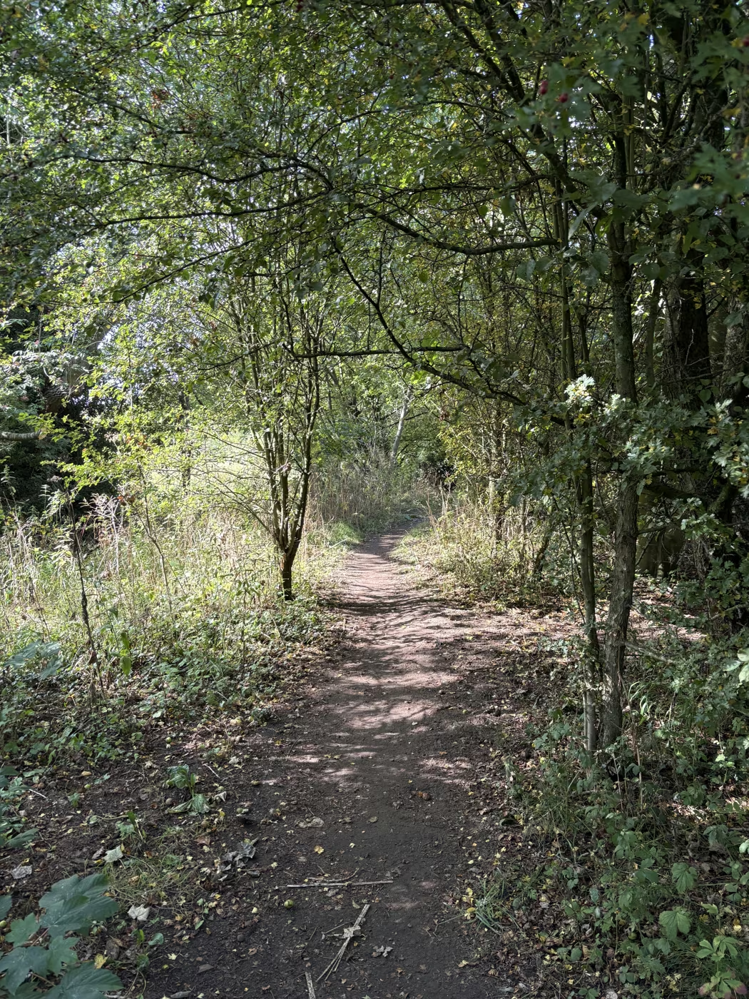
The southern half is the pleasant surprise. The leaflet calls it a shady woodland path and notes that it feels peaceful despite the traffic behind the hedgerow, and that is exactly right. Paths come in from the housing on the left as you go, which is the St Mary's estate, then the houses end and open country starts.
Where the path becomes a concrete lane and bends left into Stoneybrough Lane, there is a short diversion worth taking: up the farm lane to where it crosses the A19 on a bridge, with the Hambleton escarpment in the distance.
Best features
It is quiet, and the reason is structural rather than romantic. No car park, no signpost, no listing on any walking site, and a name nobody can search for. The people on it live here.
The bridleway sections are open to horses and bikes as well as walkers, which is unusual for field paths this close to a town and makes it useful to more people than a footpath would be.
The three access points mean you can make it whatever length you want. Behind the estate to the Sutton Bank road and back is under an hour. All the way to South Kilvington is an afternoon.
Tips
Take OS Explorer 302 or at least know that your phone may let you down. One of the footpaths in this corridor is not on the open mapping at all and another is mapped without any status attached, so an app-only walker can find themselves at a field edge with nothing on the screen.
Boots from November to March, without question. These are field edges on flat ground near a beck and they hold water.
There is livestock on parts of it, so dogs on leads where you cannot see over the hedge.
Two things to watch on the maps and the signs. The A19 here is the bypass on the east side of town, not the road through it, and not Stockton Road. And the St Mary's estate contains streets called Herriot Way and White Rose Way, neither of which has anything to do with the long-distance Herriot Way in the Dales, which is fifty miles off and nowhere near.
If you want the same two ends with a firm surface under a pushchair or a wheelchair, take the asphalt shared-use path along Stockton Road instead. It is part of National Cycle Network route 657 and runs between Thirsk and South Kilvington without a stile in sight.
The route, step by step
- Distance
- 3.0 miles
- Shape
- Circular
- Underfoot
- Field-edge track and a shady woodland path, with one kissing gate and no stiles. Firm in summer, sticky in winter.
Access One kissing gate, no stiles and no climbing, but the surface is field-edge earth throughout rather than anything made up. Fine in walking boots in dry weather; not a pushchair or wheelchair route at any time of year.
The line is the walk; the numbers match the points below. T is our door.
Point 1: The town end of the path
The path leaves the top of town and runs north along field edges. Walk it in one direction and come back another way, because there and back on the same field edge is the least interesting version of this walk.
Point 2: Past the housing estate
Paths come in from the housing on your left as you go. Then the houses end and open country starts, which is the moment the walk becomes worth doing rather than merely pleasant.
Point 3: South Kilvington
The turning point of the circuit, on the edge of the village. The ready-made route through here is three miles, an hour and a half to two hours, with one kissing gate and no stiles anywhere on it.
Point 4: The woodland stretch
The southern half is the pleasant surprise. The leaflet calls it a shady woodland path and notes that it feels peaceful despite the traffic behind the hedgerow, and that is exactly right.
Point 5: Back to the beck and the weir
The circuit drops back to the beck and the weir before returning into town, which links it straight onto the riverside walk if you want to keep going rather than stopping.
Questions people ask
The South Kilvington field path, answered
What is this walk called?
Nothing. There are 86 rights of way in this corridor on the council's map and every one of them is a number rather than a name. The only names out here belong to the lanes: Stoneybrough, South Dowber, North Dowber.
Where can I join it?
Three places. Behind the St Mary's estate off St Mary's Walk, at the far end of Thirsk where the A19 meets the Sutton Bank road, and at the South Kilvington end off Upsall Road.
How long is it?
The main run is about one and three quarter miles one way, so three and a half there and back. Ted's Walk 5 turns the southern half into a three mile circular and reckons an hour and a half to two hours.
Is it noisy, being next to the A19?
You hear it. The Visit Thirsk leaflet puts it well: the path feels quiet in spite of the traffic noise, because the hedge is between you and the road the whole way.
Is it a proper right of way?
Yes. Every section is on the council's definitive map as a public footpath or bridleway, not a permissive path. The bridleway sections are open to horses and bikes as well.
Can I take a pushchair?
No. Field edges, kissing gates, stiles and wet ground. The asphalt cycle path beside Stockton Road is the accessible route between the same two places.
Do I need a map?
Bring one. This corridor is badly under-recorded on the open mapping that phone apps use, and one of the footpaths does not appear on it at all. OS Explorer 302 covers it.
Goes well with
Make a day of it
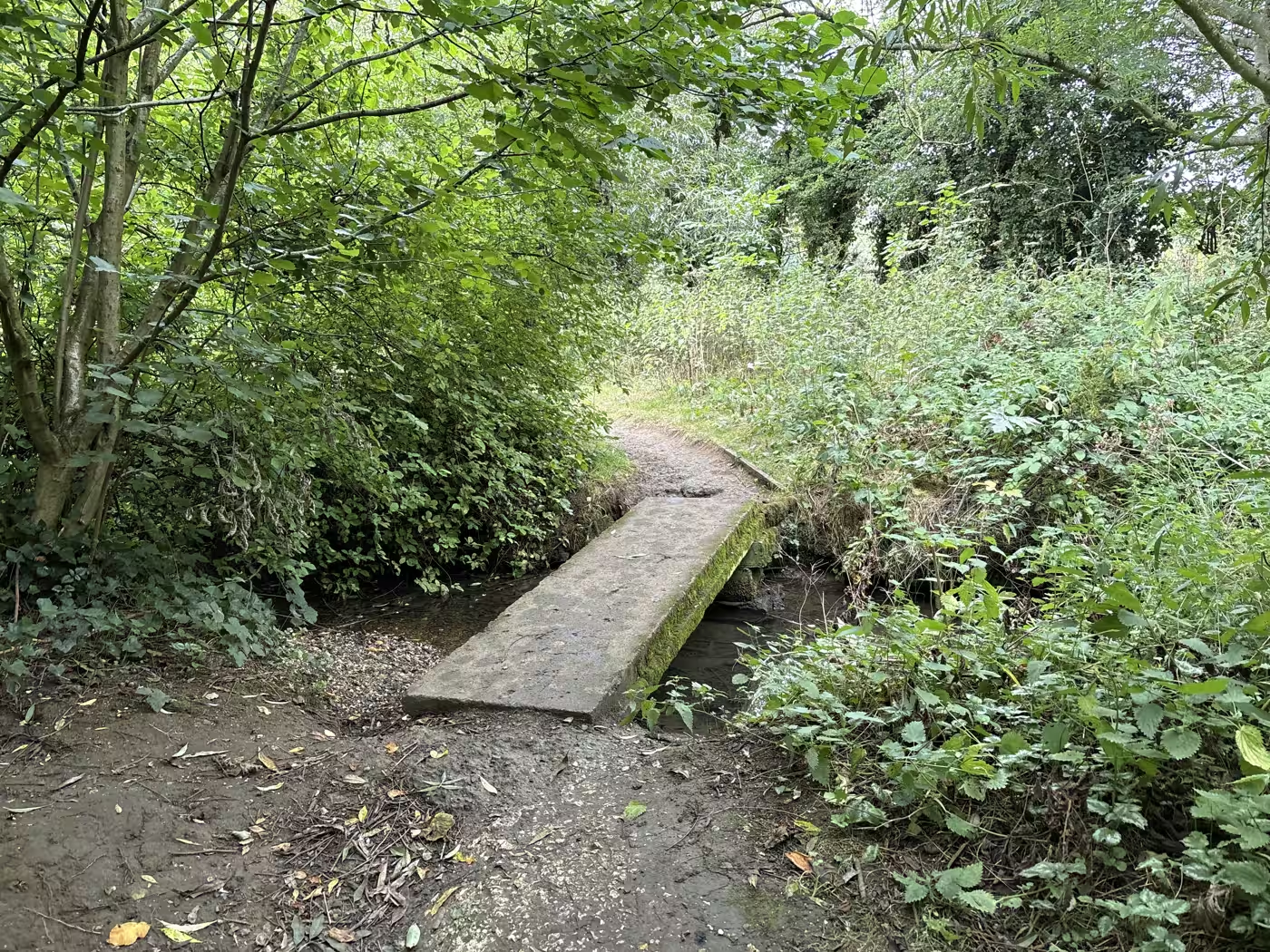
The Seven Bridges walk
The little wooded path that carries on past the weir, crossing and recrossing a stream on a string of small footbridges
12 min walk from the cafe
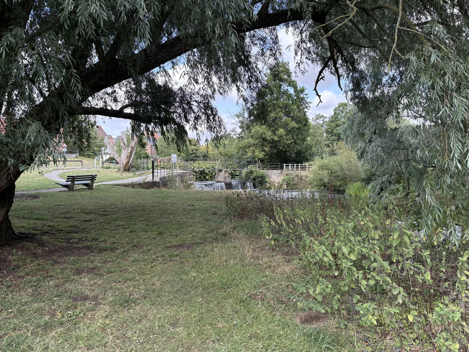
Cod Beck riverside walk
The stream that made Thirsk, with a flat two to three mile riverside loop you can pick up two minutes from the square
2 min walk from the cafe
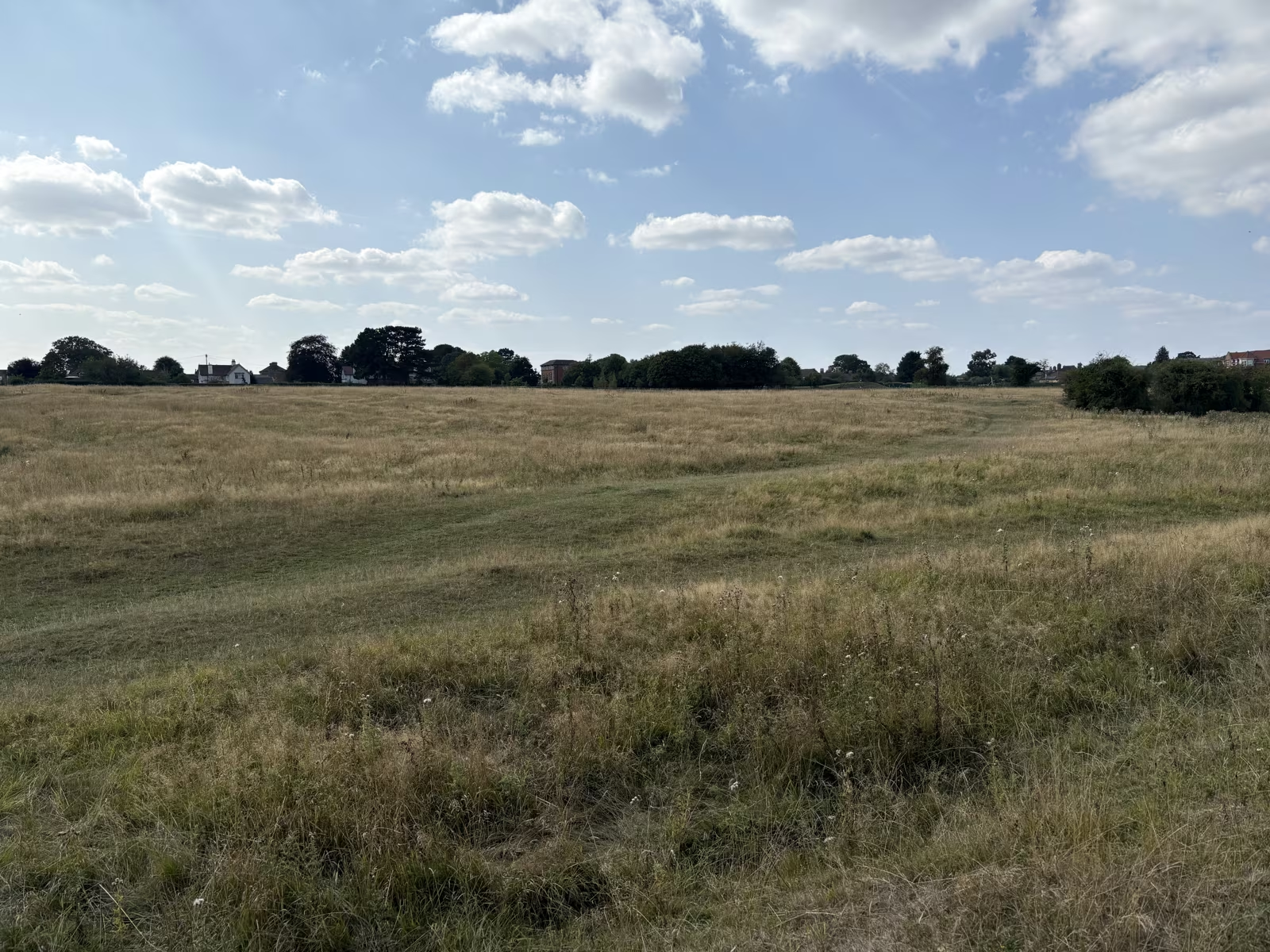
Sowerby Flatts and Pudding Pie Hill
A Victorian lime avenue, an open water meadow and an Anglo-Saxon barrow, all on a flat circuit of two to three miles from the square
20 min walk from the cafe
Start or finish at Tea Time Cafe, 87 Market Place. Hours and directions. Spotted something out of date? Tell us and we'll fix it.